 |
|
Information |
| Caribbean/Gulf of America Regional Node | ||
Information | Data | Software | Sites | Education | Feedback | Gallery
| |
|
Information |
| Caribbean/Gulf of America Regional Node | ||
Information | Data | Software | Sites | Education | Feedback | Gallery
IntroductionCoastWatch is a National Oceanic and Atmospheric Administration program that provides remotely sensed satellite and other environmental data to government decision makers and academic researchers. The Caribbean/Gulf of America Regional Node is one of several sites throughout the United States set up for the processing and distribution of CoastWatch information:
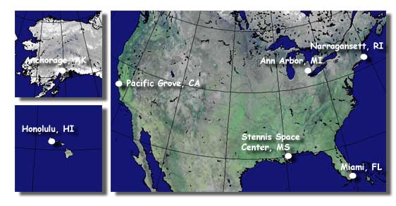
Honolulu | Anchorage | Pacific Grove | Stennis | Ann Arbor | Miami | Narragansett Any member of the government, academic, commerical, or public sectors may access data via the Caribbean/Gulf of America Regional Node web site free of charge. CoastWatch data is used in a variety of ways to monitor sea-surface-temperature and algal blooms, study fish and marine mammal distributions, and to aid in atmospheric forecasting.
CoastWatch Data
The primary data source for CoastWatch data is the Advanced Very High Resolution Radiometer (AVHRR) on the NOAA series polar orbiting weather satellites. The AVHRR sensor measures radiance from the earth in five bands or channels with 1.1 km resolution at nadir:
Channel # Wavelength Band
(microns)Primary use 1 0.58-0.68 (visible) daytime cloud, snow and ice mapping data 2 0.72-1.10 (near-IR) surface water delineation, vegetation and agriculture assessments 3 3.55-3.93 (infrared) nighttime cloud mapping, sea surface temperature measurements, land and water distinctions, and hot spot detection such as volcanic activity or forest fires 4 10.30-11.30 (infrared) cloud mapping, sea and land surface temperature measurements, and soil moisture and volcanic eruption data 5 11.50-12.50 (infrared) sea surface temperature measurements and soil moisture data Satellite estimates of sea-surface-temperature (SST) are made by converting the radiance measured in the infrared channels to brightness temperature and then using a multichannel technique to calculate SST to within ±0.5°C. Cloud identification masks are also created using visible and infrared channels with a series of spectral gradient, difference, and threshold tests.
How to Access
The Caribbean/Gulf of America Regional Node web site is designed to supply users with satellite data files and previews in near-real-time. Image data is available for a number of different regions and product data types. Access to CoastWatch satellite data is free and unrestricted.
CoastWatch users can visit the data selection page to download data files for use with one of the CoastWatch software packages, plot data using the web site online preview, or convert data to other data formats for use in GIS or scientific plotting packages.
Questions/Comments
The CoastWatch Caribbean/Gulf of America Node is currently operated by the NOAA Atlantic Oceanographic and Meteorological Laborartory (AOML) Remote Sensing Group. Please feel free to contact us for any questions or comments:
- Thomas D. Leming, CoastWatch Caribbean/Gulf of America Node Manager
- Joaquin A. Trinanes, CoastWatch Caribbean/Gulf of America Op. Manager at AOML
or fill out our online feedback form.
 |
Back to main page | USDOC | NOAA | NESDIS | CoastWatch |