|
|
Gallery Hurricanes Katrina and Rita |
| Caribbean/Gulf of Mexico Regional Node | ||
Information | Data | Software | Sites | Education | Feedback |
| |
|
Gallery Hurricanes Katrina and Rita |
| Caribbean/Gulf of Mexico Regional Node | ||
Information | Data | Software | Sites | Education | Feedback |
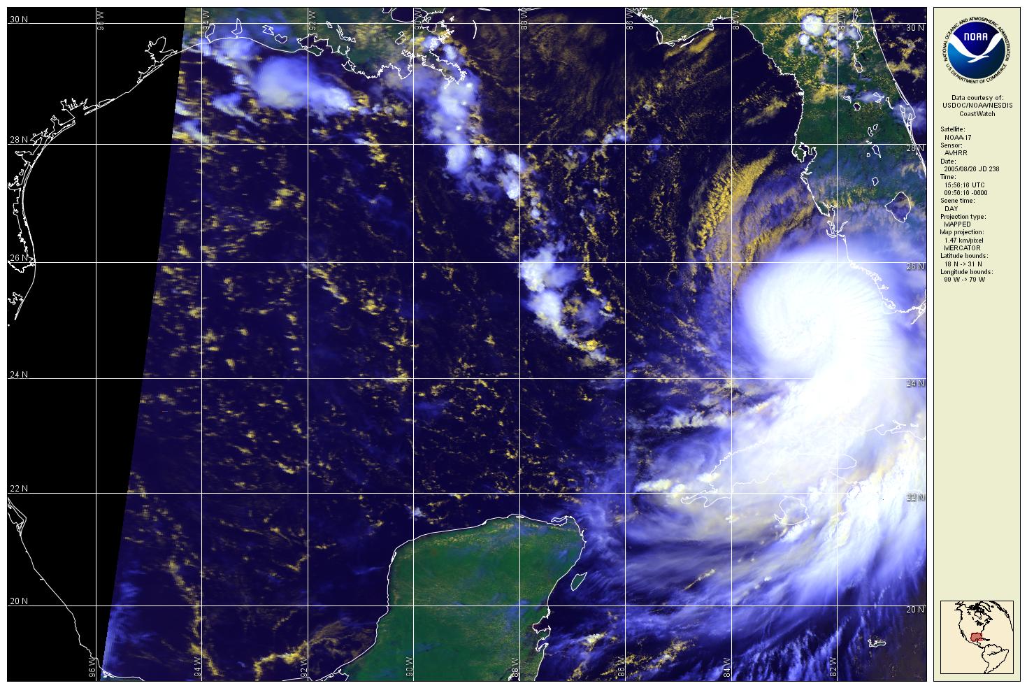
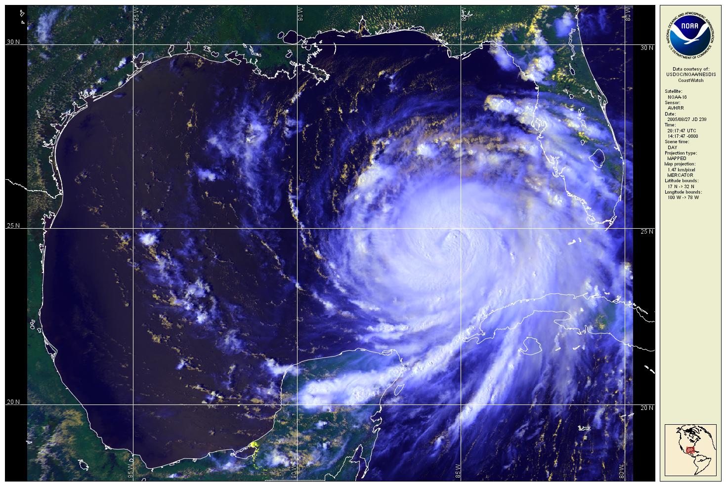
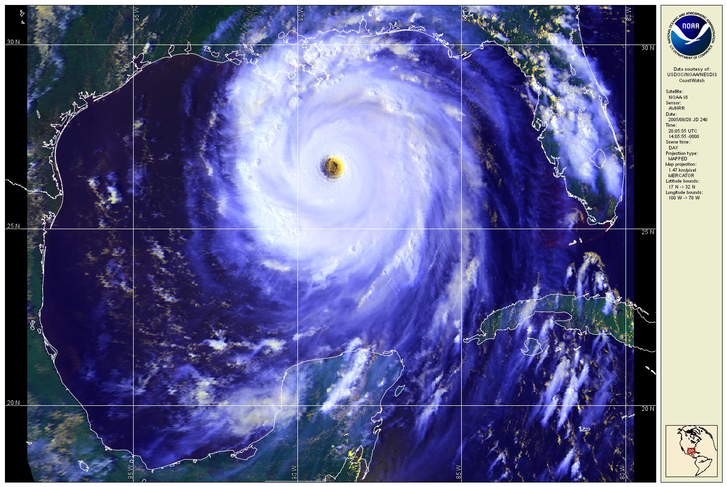
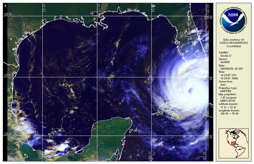
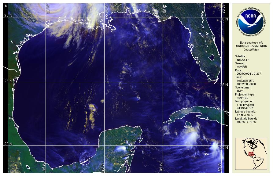
These images are red, green, and blue color composites of channels 1, 2 and 4 acquired by the Advanced Very High Resolution Radiometer carried aboard the NOAA-16 and NOAA-17 polar orbiting satellites. The data were downloaded from the NOAA NESDIS Comprehensive Large Array-data Stewardship System (www.class.noaa.gov) and processed with the CoastWatch Data Analysis Tool (CDAT) which is part of the CoastWatch Software Utilities v3.x package (http://coastwatch.noaa.gov/cw_software.html).
Hurricane Katrina 2005-08-26 2005-08-27 2005-08-28 2005-08-29
Hurricane Rita 2005-09-20 2005-09-22 2005-09-23 2005-09-24
 |
Back to main page | USDOC | NOAA | NESDIS | CoastWatch |